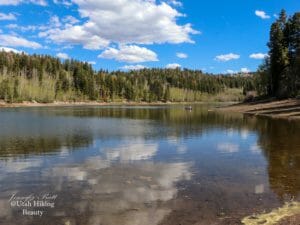
Mount Wolverine is the peak that separates Brighton’s Lake Mary with Twin Lakes and is between Little and Big Cottonwood Canyon.

Directions
This trail begins at the Catherine’s Pass Trailhead. There is a $12/vehicle fee to drive up above Alta on the Albion Basin Road.


Park in the Catherine’s Pass Trailhead. The trail begins across the street. This photo is looking back towards the parking lot.

The trail starts out under the Sunnyside Lift and then winds up the mountains.


Here a view looking backwards.


Continue up to the meadow.


Even though the wildflowers were past prime, there were some lovely Indian Paintbrush.

Then take the trail up over the hill.


At the crest you are between Little and Big Cottonwood Canyons, or Catherine’s Pass. There is a sign. This is the junction, with Sunset Peak to the right, Lake Catherine straight ahead, and Mount Tuscarora and Mount Wolverine to the left.


Head up the trail to the right. There are a few places you have to climb up the rocks.


I love it when the wildflowers were in bloom!


This mountain can be climbed from Big Cottonwood Canyon or Little Cottonwood Canyon, but it is longer from Big Cottonwood. There is some scrambling at the top, but it is only a moderate difficulty. You can start to see the lakes as you get near the top.


The views of Lakes Mary, Martha, and Catherine are amazing from the top!

This first peak you reach is Mt. Tuscarora. The views are impressive!


Once we saw this chipmunk stuffing his face with grass-hilarious!


Then you turn to the left to start heading over to Mt. Wolverine.


There are great views of Lake Mary along this area.


Then you reach the top!


On the left you see part of Twin Lakes and on the right you see Lake Mary.


The 360° views from the top are amazing! You can look over into Heber, see both Big and Little Cottonwood Canyon, see so many mountains, several lakes and even a little view of the Salt Lake valley!

The mountains directly to the right of that view of the valley are Mount Superior and Monte Cristo.

Looking the other direction, you can see Devil’s Castle, Sugarloaf, Cecret Lake, and Twin Peaks.


From Mount Wolverine, you can continue along the ridgeline to Patsy Marley Peak, detour to Mount Millicent, or turn around and head back, potentially including Sunset Peak. Here are some views from Patsy Marley towards Mount Wolverine.


Mount Wolverine via Catherine’s Pass
Stats: Distance – 4.1 miles round trip
Approximate hiking time – 2-3 hours
Elevation gain – 1453 feet
Difficulty – Difficult
Trail – well maintained trail of dirt and rocks, scrambling over rocks
Bathrooms – At trailhead
Seasons to hike – July-October
Permits needed – $8 to park in Albion Basin (Add’s 1.7 mile and some elevation to walk from Alta for free parking)
Pets allowed – No
Mount Wolverine via Brighton Lakes
Stats: Distance – 5.9 miles round trip
Approximate hiking time – 2-4 hours
Elevation gain – 2076 feet
Difficulty – Difficult
Trail – well maintained trail of dirt and rocks, scrambling over rocks
Bathrooms – At trailhead
Seasons to hike – July – October
Permits needed – None
Pets allowed – No